The controversial plan for a Cooks River data centre
A fight is shaping up between the increasingly vocal river community and the proponents of one of Sydney's most strategically valuable redevelopment opportunities. As data centre proposals roll out in neighbourhoods across Sydney, the last large open green space in the Southern reach of the Cooks River comes under threat of massive tree-clearing and total transformation. While residents are placated with promise of a public park, many express concern at the environmental impacts and lack of consultation. Niall Edwards-FitzSimons investigates for Goolay’yari Cooks River Radio
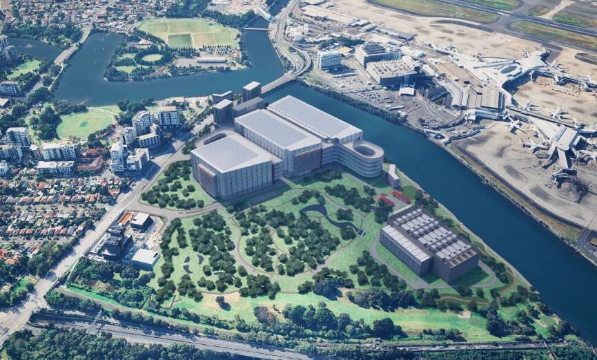
It’s wedged between Sydney Airport, Port Botany and major arterial roads, hidden behind fences and motorways. From the road, it’s almost impossible to see beyond the locked gates. From the river, though, it appears: an unexpectedly broad expanse of trees and open grasslands, packed with the colour and movement of bird life.
The Kogarah Golf Course is an expanse of green space just across the river from Sydney Airport
Today, the future of this landscape hangs on one of the largest redevelopment proposals ever put forward for the Cooks River corridor.
The $2.9 billion proposal would transform the former Kogarah Golf Course into a logistics and trade precinct, with the possibility of a major data centre occupying part of the site. It would also create a new public park on council-owned land and a continuous public path along the river's edge.
For supporters, the project represents an opportunity to unlock strategically located land beside Sydney Airport. Stockland, one of the developers behind the proposal, argues the site is “well-placed to support more efficient movement of goods and services across Sydney."
But for many local residents, community groups and river users, it represents something quite different: a test of whether planning assumptions forged decades ago still reflect how Sydneysiders value the Cooks River today.
The proposal arrives after years of planning, rezoning and redevelopment attempts. Few people interviewed for this story believed development would not proceed in some form. Instead, a debate has arisen over what will ultimately be built, how much of the existing landscape will survive, and whether the river itself will be protected and improved, or further degraded.
Behind the fence
Approaching the former golf course entrance from Cahill Park or down Levey Street, visitors are met by warning signs.
High black security fencing has been built over the original fence and gate. Notices warn against trespassing. Surveillance cameras monitor the entrance twenty-four hours a day. A sign explains that fencing was upgraded "to keep the community safe" and informs residents that the riverfront is no longer publicly accessible while redevelopment plans progress.
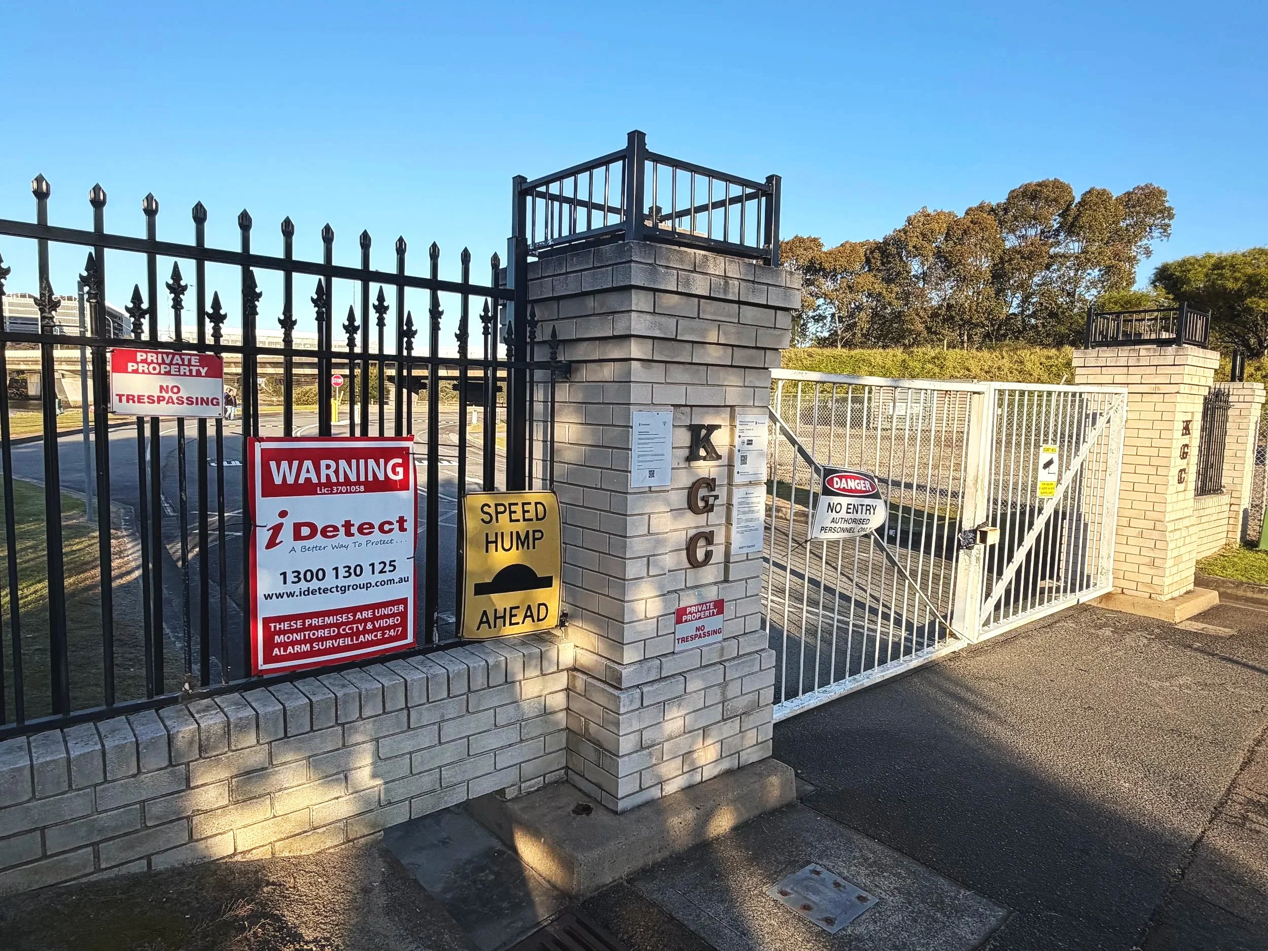
The gates to the former Kogarah Golf Club are covered in warning signs
Beyond the fence lies one of the largest remaining green spaces on this part of the river, yet almost nobody can enter it. Apart from one person.
During my visit to the site, the caretaker arrived in his ute on the other side of the gate, and got out, barefoot, to unlock it. He told me he’s maintained the golf course for 35 years and continues to care for the grounds even now the golfers have disappeared. Asked what he thought about the redevelopment, he offered neither outright support nor opposition. "There's good and bad," he said.
He spoke about the sadness he anticipates of watching a place he’s looked after for more than three decades disappear. Much of what he had spent years maintaining will be demolished. At the same time, he emphasised that roughly half the site will become public park. "It's gonna be great that there's green space for the community," he said. "But someone's gotta pay for it."
Under the proposal, developers would create a valuable trade precinct capable of generating substantial commercial returns. In exchange, the public would receive new public parkland (on already council-owned land), apparently mostly funded through developer contributions.
Whether that exchange represents good value depends largely on what people believe already exists on the site, and what they think might be lost.
A place hidden in plain sight
Although it’s been a golf course for over 70 years, the land here has accumulated far more complicated layers of history than its manicured fairways suggest.
The site was first heavily modified in the late nineteenth century when it formed part of the Arncliffe Sewerage Farm, serving as the southern terminus for Sydney's expanding sewerage system. Agriculture and market gardens followed in the early twentieth century, although sewerage operations continued alongside.
The Bonnie Doon Golf Course was established in the 1930s, but during the 1940s the Army and Airforce occupied the site, building radio training facilities, which were then left derelict before Kogarah Golf Club took over in the 1950s.

Golfers at the then Bonnie Doon Golf Club in 1938. Mitchell Library, State Library of NSW [hood_16947 / Home & Away 16947]
Successive decades brought further change. Airport expansion altered the course of the lower Cooks River and nearby Muddy Creek. Motorway construction disturbed parts of the land through the 1990s and early 2000s. By the time the golf club ceased operating in 2025, the site had spent well over a century adapting to changing ideas about what this corner of Sydney should become.
And that history has also shaped public perceptions. To many, the lower Cooks has long been regarded as degraded industrial land; a river already transformed beyond recognition. Those assumptions underpin much of the strategic planning that’s followed.
But while the site's past can help explain why transformational redevelopments have repeatedly been proposed, it doesn’t explain why this particular proposal now appears so inevitable. The answer lies in a planning process stretching back more than 20 years.
Twenty years in the making
The current proposal didn’t emerge overnight. Long before warehouses and potential data centres entered public discussion, governments and developers had already identified the site as one of Sydney's most strategically valuable redevelopment opportunities.
In 2004, the NSW Government unveiled plans for a technology park known as Cooks Cove North. A formal development application followed in 2005 and received approval the following year. But then the Global Financial Crisis arrived, and this killed the project.
In 2016, a new proposal envisioned something very different: high-rise residential apartments extending across the golf course and adjoining land. The scheme also proposed reconstructing the golf course further south, over the top of Barton Park, local wetlands and the heritage-listed Arncliffe Market Gardens.
Community opposition was intense and the application was withdrawn in 2017. A revised proposal returned the following year but failed to secure support from Bayside Council, and once again the project stalled.
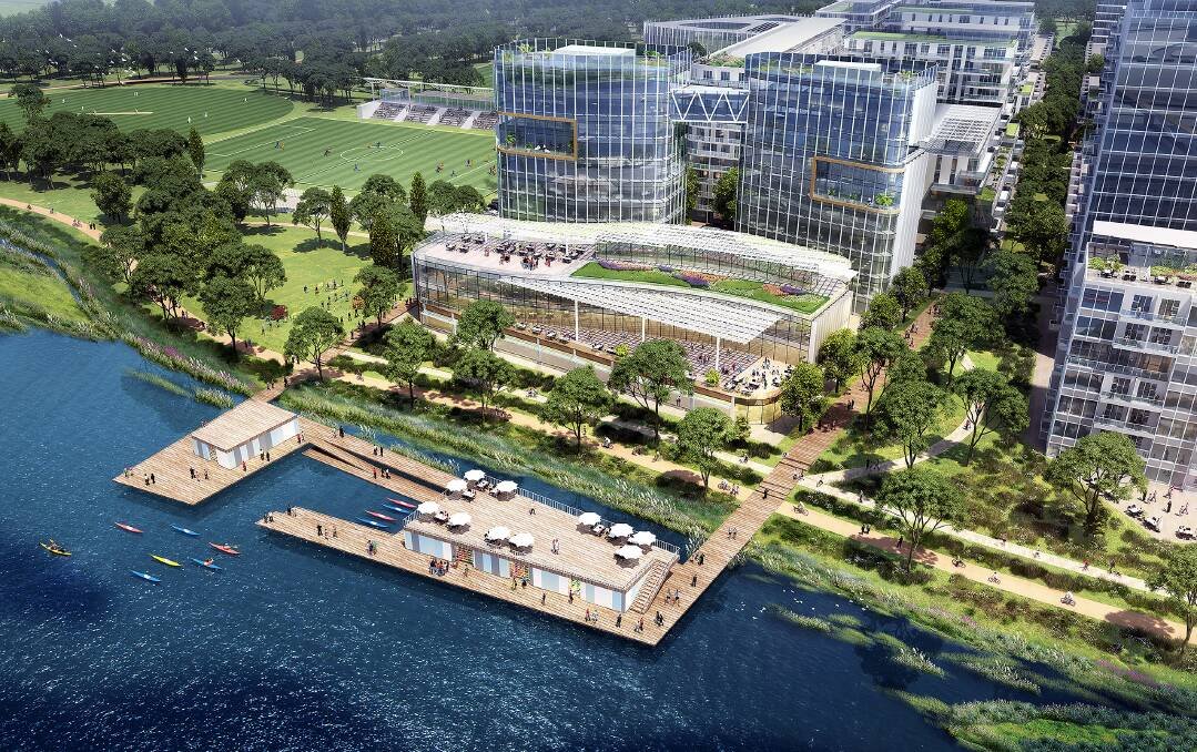
3D render of high rise apartments from the the 2018 development plan. St George and Sutherland Shire Leader
The developers changed strategy. In 2022, the NSW Government issued what is known as a Gateway Determination, concluding that transforming the golf course into a major enterprise precinct possessed sufficient strategic merit to proceed to public and agency scrutiny.
The rezoning proposal entered public exhibition in 2023, and two years later the land was rezoned to SP4 Enterprise, creating the planning framework necessary for the current State Significant Development proposal.
Different proposals have come and gone. But one assumption remained largely intact: that the former golf course would eventually be flattened and become something more economically rewarding. For many people, the question is no longer whether development will occur. It is whether the assumptions that first set this process in motion still reflect the way the river is understood today.
What would actually be built?
For most people the phrase "logistics and trade-related precinct" does little to explain what would actually replace the green space here.
At its heart, the development is a warehouse complex. Goods would arrive from nearby Sydney Airport and Port Botany, be sorted, stored, and redistributed by freight across metropolitan Sydney. The proposal also allows for office space, food and drink premises, hotel accommodation and advertising structures.
One building, however, has attracted particular attention. This is Block 3C, which could become a data centre.
That possibility has become one of the defining features of public debate, because it represents a type of infrastructure that many communities are only beginning to understand.
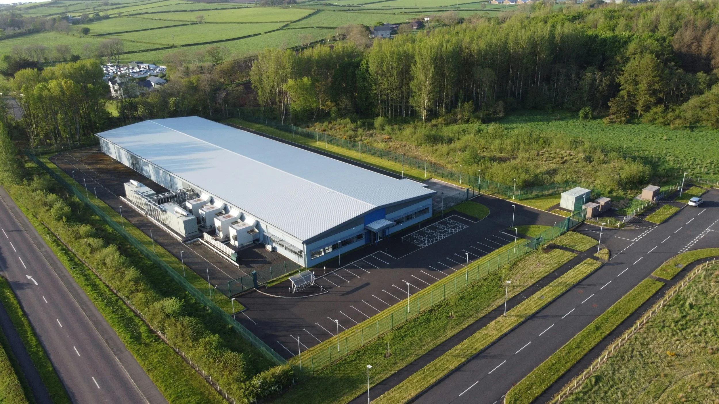
Large data centres are appearing across Sydney, and across the world. Unsplash: Geoffrey Moffett
Data centres have rapidly become synonymous with artificial intelligence, cloud computing and the enormous digital infrastructure underpinning modern life. As governments and technology companies race to expand AI capability, demand for facilities capable of housing thousands of servers has accelerated dramatically.
Dr Bronwyn Cumbo, a lecturer and researcher at the University of Technology Sydney whose work examines digital infrastructure and its social and environmental impacts, says these facilities are already deeply embedded in everyday life. "We need data centres to support our modern digital society," she says. "We all rely on them for everything we do." However she notes that "AI and gen AI particularly is... operating at a much larger scale, so that's why we're seeing this much larger infrastructure coming in."
The question then becomes, why is the former golf course considered a suitable location?
Dr Cumbo describes the kinds of places developers across Australia are searching for: "they're looking for…established energy and water infrastructure and digital infrastructure," including fibre optic connections and access to submarine cable networks. "Any available industrial land in Sydney is ripe for the picking."
The golf course may be open green space now, but following its rezoning the land has effectively been designated for employment and industrial uses. Dr Michael Vardon, an environmental accountant at the Australian National University, reached much the same conclusion as Cumbo. "I'm not really sure," he says when asked why this particular site had been selected. "I could take a guess: that it's actually available."
Availability, however, is only one consideration. Vardon argues that every development involves weighing competing values: what the land currently provides, what alternative uses are possible, and the physical characteristics of the site itself, including flood risk and existing vegetation. "Everything's a trade-off," he says. "Sometimes you can get the win-wins... But then often you do get the trade-offs.
Economic benefits and resource costs
Supporters of data centres often point to the economic benefits appearing within the emerging AI economy. Yet those gains don’t remain in the communities where the infrastructure is built.
Bronwyn Cumbo sees the potential national benefits through AI innovation, but says there is remarkable uncertainty: "we don't know what data is being housed in these data centres…what they’re being used for." She says that Australia is attempting to position itself as a regional leader in AI infrastructure, and "what that means on the ground is building these data centres at pace... without clear understanding of where the benefit is lying."
Prime Minister Anthony Albanese AI strategy announcement, 14 July 2026. ABC News
That uncertainty extends to local employment, with Dr Cumbo pointing out that after the short boom of construction jobs is over locals are unlikely to find employment here, due to the small and specialised nature of a data centre workforce. “I don’t know how people are perceiving the economic benefits to a local area,” she says, “there aren’t really many.”
And the experts say there’s another area in which our understanding is very limited: what these facilities consume. Keeping thousands of computer servers operating continuously requires substantial cooling systems, and those systems demand significant inputs of energy and water. But exactly how much remains difficult to quantify.

Data centre server banks require constant cooling. Unsplash: İsmail Enes Ayhan
According to Dr Vardon, one of the biggest challenges is a lack of the reliable public information needed to make these decisions. "It's really hard to have a debate when you don't know the starting point."
Vardon notes that the Kogarah proposal is only one among many such projects currently under consideration across Sydney. "The key point," he says, "is... there's sort of a cumulative effect." If enough projects proceed simultaneously, the demand on essential infrastructure could become significant. Vardon points to Sydney Water's projections that data centres could account for as much as a quarter of Sydney's total water consumption within the next decade.
Those broader concerns have shaped local political opposition. Canterbury-Bankstown Greens councillor Conroy Blood says his party's online petition and local doorknocking campaign against the development focuses particularly on the proposed data centre component because of what it sees as the associated environmental risks.
"We're opposed to it," he says, citing concerns about electricity demand, water consumption, potential chemical pollution and impacts on nearby wildlife. For Blood, the environmental costs outweigh any economic gains.
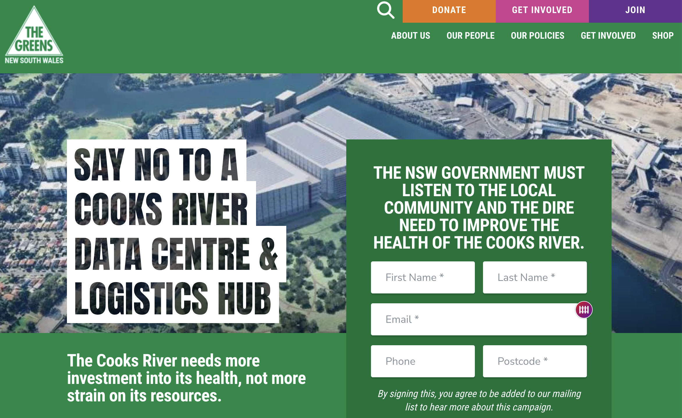
The NSW Greens have started a petition against the proposal. NSW Greens
What stands to be lost?
With little opportunity to see what actually exists there, the former golf course can seem little more than redundant private land awaiting redevelopment. Seen from the river, however, it tells a different story.
Members of the River Canoe Club paddle past the site several times each week, giving them perhaps the best view of the site anyone’s able to get. Dr Jenny Kent, a local resident and member of the club, describes what members see: “from the water, it's mostly just a green space with loads of trees… There's some significant Moreton Bay figs. There's some really large casuarina trees and other eucalypts."
The golf course site hosts a large number of mature trees
Kent says the vegetation has become one of the defining visual features of this reach of the river. Increasingly, so too has the wildlife. On the morning we spoke, club members watched three birds of a rare species emerge from the golf course, which isn’t an isolated event. "For about the last four to six weeks," she says, "each Friday I've been out paddling, I've seen White-Bellied Sea Eagles come out of that site.” She suspects the closure of the golf course, with less people coming and going, may have altered the way wildlife uses the landscape.
For those who spend time on the river, observations like these have prompted a broader reassessment of what had previously been dismissed as little more than manicured open space. Even from outside the locked gates, there are signs of ecological activity. Looking over the security fencing towards the course, flocks of Welcome Swallows dart continuously above the grass, while mature trees rise above the skyline.
According to the Environmental Impact Statement accompanying the proposal, 791 trees would be removed during the project's early works. The assessment also identifies that habitat used by birds, bats, frogs, and reptiles, and remnants of natural mangrove and saltmarsh vegetation, would all be destroyed. It proposes mitigation measures including staged clearing, fauna rescue, habitat restoration and ecological monitoring, but does not describe the finished landscape in terms that allow a straightforward comparison with what exists today.
Bird life in a section of remnant wetland at the Kogarah Golf Course. Video: supplied
For Kent, the question is not whether the land could become something else, but whether enough value has been placed on what already exists. "That's something I've been thinking about a lot," she says. "How precious that green space really is."
Beyond the buildings
Environmental concerns raised by community groups extend beyond the removal of trees.
The River Canoe Club's submission focused on the proximity of the proposed buildings to the river, the scale of vegetation removal and the potential impacts on water quality. "We're really looking at how, if the development was to go ahead, we'd actually improve the river landscape rather than contribute further to its degradation," Jenny Kent says.
Similar concerns were raised by the Cooks River Alliance, the organisation bringing together councils and Sydney Water to coordinate restoration across the catchment. Senior Engagement Officer Jason L'Ecuyer says the Alliance's formal position is that the concept proposal should not proceed in its current form.
Instead, the Alliance is seeking several significant changes: a minimum 4% developer contribution for river restoration, a minimum 40-metre riparian corridor (the open land alongside a river), a fully naturalised riverbank, a rearrangement of the site to prevent the buildings cutting the park off from the river, and earlier delivery of public open space.
L'Ecuyer believes that aspects of the proposal appear out of step with broader restoration efforts underway elsewhere on the Cooks River. "It just feels incongruent with a lot of other things that are happening elsewhere in the catchment," he says, contrasting the proposal's reliance on seawalls with increasing emphasis on wetlands and water-sensitive urban design.
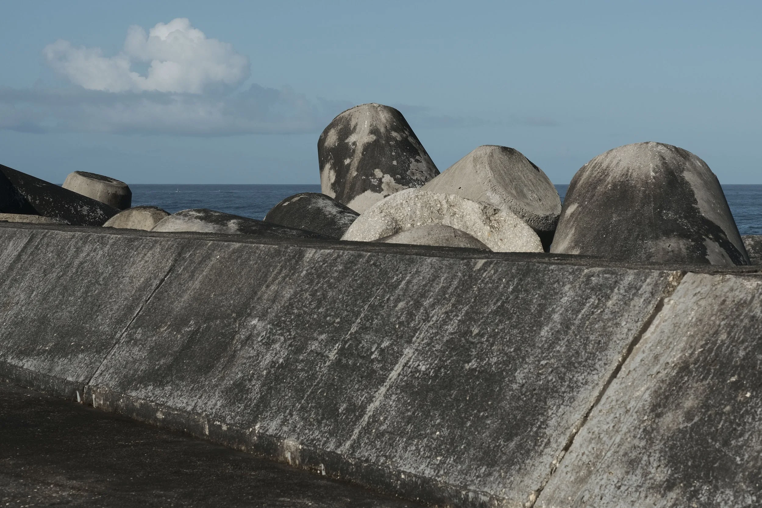
Jason L’Ecuyer says planning has generally has moved away from ‘grey infrastructure’ like concrete seawalls. Pexel: Samuel Jerónimo
And if the data centre does end up being built, this comes with the possibility of significant disruption to local wildlife. Dr Bronwyn Cumbo points to “the impact of the vibrations, the noise, the light,” saying “it’s going to impact the local biodiversity.”
Construction impacts also concern river users. The Environmental Impact Statement acknowledges potential effects on water quality during earthworks and explains how these would be managed, repeatedly using language centred on minimising and mitigating impacts rather than eliminating them altogether.
L'Ecuyer argues that sediment entering this tidal section of the river wouldn’t simply wash out to sea. "It's all part of the same system," he says, "you get that sediment flushed up the river with the tide."
For canoe club members, those concerns are deeply personal. "We're sort of like the eyes of the river," Kent says. "The water quality is important for us because we’re putting our boats in, part of us sometimes ends up in there... but we're also concerned because we love the river."
The puzzle of the riverfront
One feature of the proposal has puzzled almost everyone interviewed for this investigation. The new public park promised as part of the redevelopment isn’t slated to occupy the river frontage. Instead, the warehouses would line the river, while the park would sit behind them.
Neither Dr Bronwyn Cumbo nor Dr Michael Vardon could explain why the site might be designed that way. Jason L'Ecuyer suspects the layout reflects operational efficiency: "I look at the proposal and I see a design that's maximum efficiency between the logistics hub and the airport, with little consideration for the river," he says. It’s also unclear if there’s any plan for the data centre to draw water from or discharge it to the river.
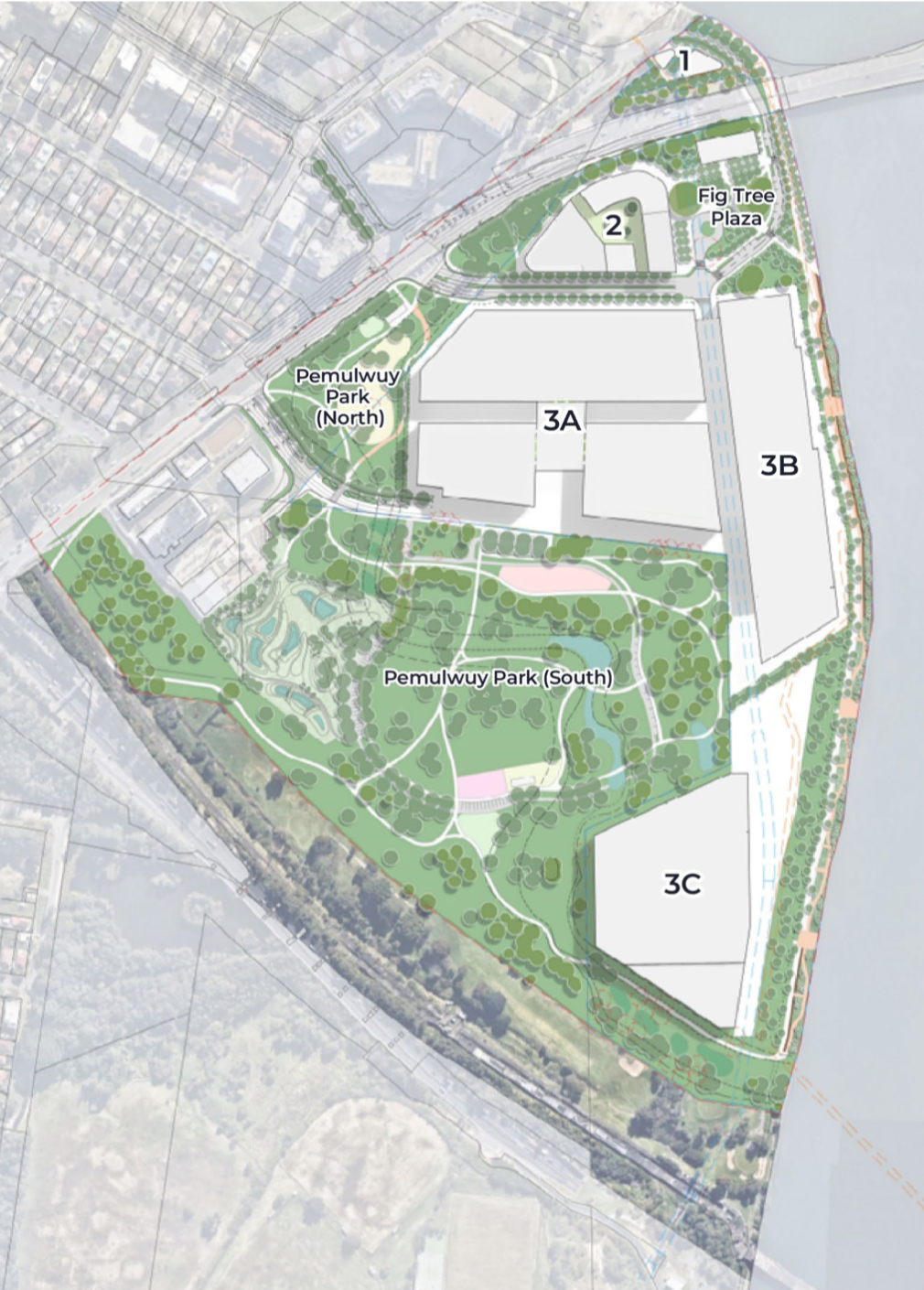
Buildings cut the park off from the riverfront in the current proposal. Scoping Report: Ethos Urban
But the explanation may be even simpler. Historical land records reveal that the golf course has never been a single parcel of land. Ownership has long been divided between different public authorities and the golf club itself.
Maps contained within earlier planning documents show sections owned by what is now Bayside Council, Sydney Water, Sydney Airport and the former Roads and Maritime Services, alongside a parcel of land purchased outright by the golf club in 1972. This is the section along the river, and since the club sold up it’s now in the hands of developer John Boyd.
Looking at the proposed development layout next to a map of the land ownership, the results are striking. The buildings closely follow the boundaries of the privately owned riverfront land, even down to the strangely trapezoid potential data centre, while the park occupies land already owned by Bayside Council, further from the river.
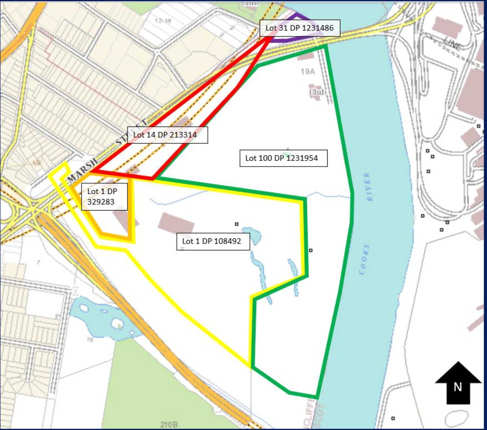
The shape of council-owned (yellow/red) and developer-owned (green) blocks explains the proposed layout. Gateway Determination 2022: NSW Government
Asked whether a land swap had been considered, to allow the park to front the river, Bayside Council confirmed it had discussed the idea with the developers and "would welcome the opportunity to explore this further.” However, they noted that this doesn’t form part of the current proposal. Stockland didn’t respond to that specific question before the reporting deadline.
If that explanation is correct, one of the proposal's most controversial features may owe less to any purposeful design choices and more to arbitrary property boundaries established more than half a century ago.
Community consultation and the politics of planning
As debate over this proposal has intensified, attention has shifted from the development itself to the process through which it’s being assessed.
Bayside Council raised concerns about the proposal's height, scale and impacts on the future park. But they emphasised that, because the project is classified as State Significant Development (SSD), the assessment rests with the New South Wales Department of Planning, Housing and Infrastructure rather than the council itself.
When asked why the project has been given this designation, the Department and the Planning Minister Paul Scully both provided a boilerplate explanation that projects receive SSD status because of their economic, environmental or social importance to NSW. The Department also emphasised that the current application seeks approval only for the concept proposal, with separate applications required before any individual buildings could proceed.
Local federal MP Ash Ambihaipahar acknowledged residents' concerns and said she had raised issues relating to the river, the environment and traffic directly with Stockland. Local state MPs Stephen Kamper, Jo Haylen and Sophie Cotsis did not respond before deadline.
The Greens, while accepting that some form of logistics hub may ultimately be built, argue the current proposal would require such extensive changes that it should be replaced entirely. "It would have to require a whole new DA," says Conroy Blood.
And there’s a broader question about community engagement. Jason L'Ecuyer says the developer's early consultation attracted only a handful of participants before the proposal entered formal exhibition, with 12 respondents to a survey and 22 attendees to two drop-in sessions late 2025. Once the plans became publicly available, however, the response changed dramatically. "The proposal got 655 submissions," he says, "three of which were in favour of the development."
Dr Jenny Kent, whose academic work includes community engagement, says she was surprised by the approach. "For a $2.9 billion proposal," she says, "it seems like they invested very little in terms of community consultation." Blood goes further, describing the process as "a box-ticking exercise".
The complexity of the planning documents compounded the problem. Both L'Ecuyer and Kent questioned how accessible that material would be for ordinary residents. "I found it personally really difficult to navigate all of the information," L'Ecuyer says.
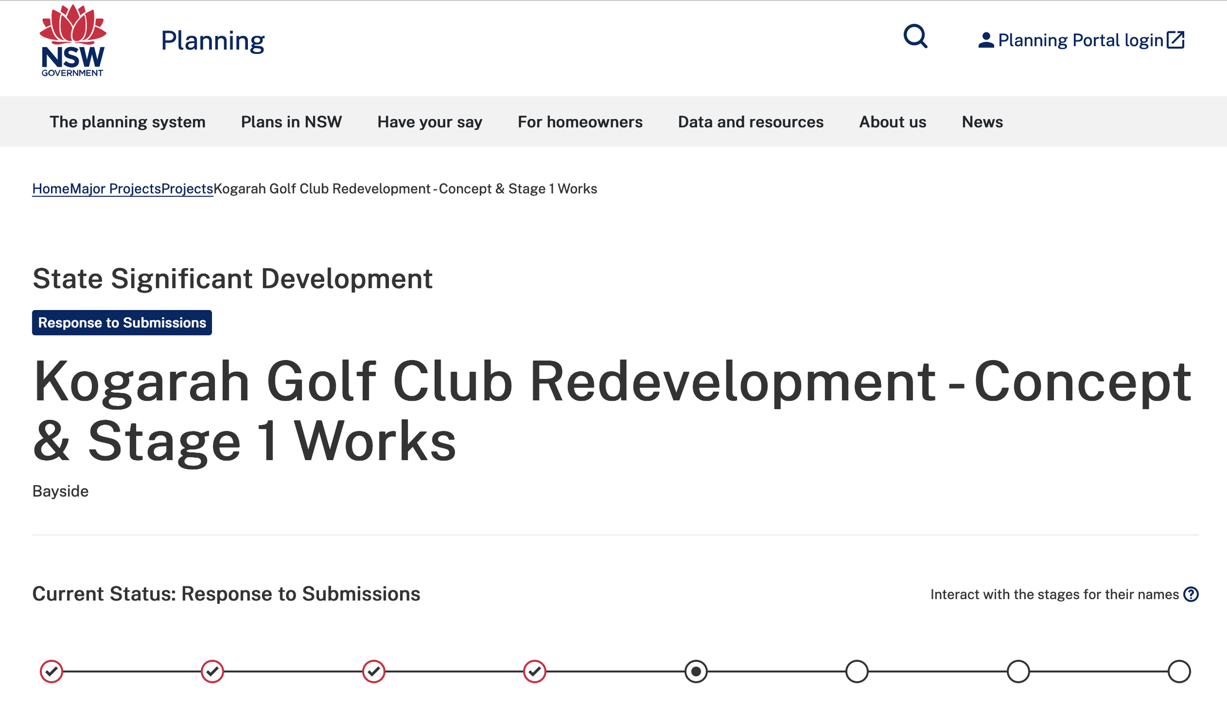
The NSW Government planning portal can be tricky to navigate. NSW Government
Dr Bronwyn Cumbo says the challenge is particularly acute when proposals involve data centres, where communities are often trying to understand unfamiliar technologies. "This is why we need communities involved earlier on," she says, "because data centres do transform local places."
Stockland, in its statement, says it recognises that the Cooks River is highly valued, that it “appreciate[s] the effort the community has invested in…providing feedback” and will be “reaching out to community groups soon.”
Two visions for the river’s future
While the experts, community representatives and local politicians have all identified issues with this proposal, the question remains whether locals’ voices will end up having an impact.
Having attracted (significantly) more than 50 objections through the planning portal, the decision to approve the application is out of the hands of the Minister Paul Scully and instead rests with the Independent Planning Commission.
Viewed purely as a planning issue, the proposal is about warehouses, freight movements, building envelopes and environmental mitigation. But viewed through the history of the Cooks River, it becomes something larger.
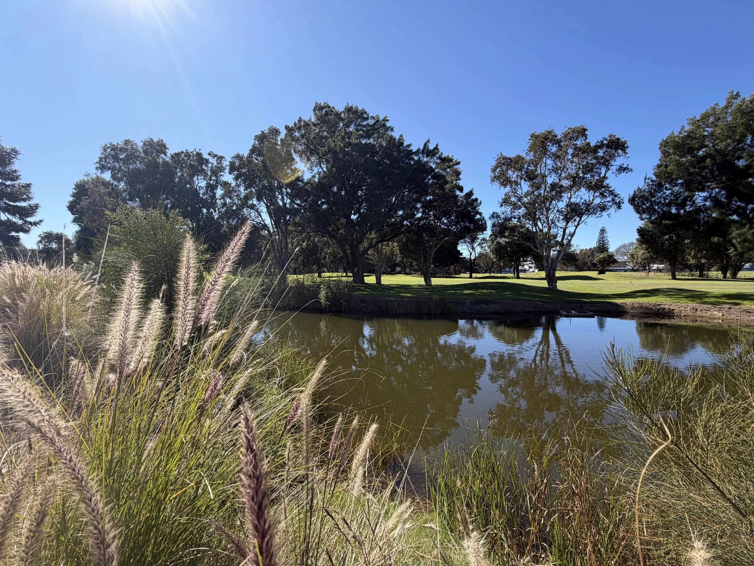
Remnant wetland at the Kogarah Golf Course. Photo: supplied
For much of the past century, this area of the river was regarded as an unnatural landscape, host first to sewerage, then tarmac and asphalt, and little natural value. That assumption underpins two decades of redevelopment proposals at this site that have steadily advanced, regardless of whether the intended future was a technology park, apartment towers or a logistics precinct.
Yet the landscape around the river has changed in ways that planning documents cannot easily measure. More people paddle its waters each week. Volunteers restore wetlands and bushland, monitor wildlife and scrutinise the impacts of local construction. People are more invested in what happens here than they were before.
The proposal for the Kogarah Golf Course sits at the intersection of those two histories. One imagines the site primarily as strategically-located, now industrially-zoned, available land. The other sees it as an increasingly valued part of a recovering urban river, desperate for preserved green spaces.
The decision now before the Commission involves more than simply what should be built on the golf course. It is about which of those visions will shape the next chapter of the Cooks River, and who will get a say.
– Niall Edwards-FitzSimons for Goolay’yari Cooks River Radio
To read all the statements we received for this story in full: click here
To hear more about this story, listen to the podcast version below, or on podcast platforms: